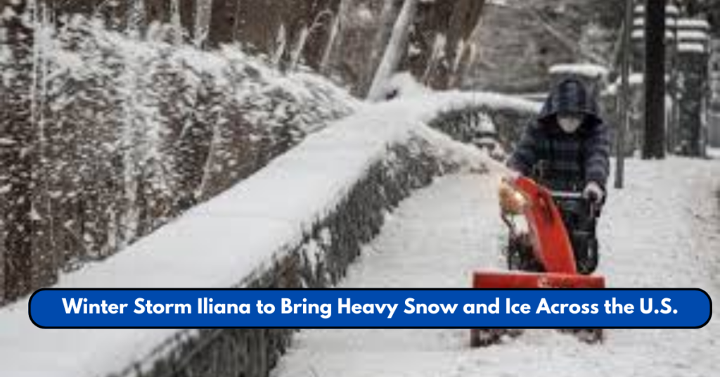
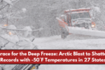
Winter Storm Iliana is poised to bring significant snowfall and ice accumulation across the central and eastern United States, impacting millions from the Plains to the Northeast. Cities including Chicago, Kansas City, Detroit, and Boston are expected to experience hazardous conditions with potential travel disruptions, power outages, and severe winter weather hazards.
The storm, which developed over the Rockies and Central Plains, is rapidly intensifying as it moves eastward, leading to widespread winter storm warnings and advisories issued by the National Weather Service (NWS). (NWS)
Storm Timeline and Affected Areas
Tuesday Night (February 11, 2025):
- Snow begins developing over the Rockies and Central Plains, impacting cities like Denver, Omaha, and Kansas City.
- Freezing rain and sleet are expected in parts of Oklahoma, Missouri, and northern Texas.
Wednesday (February 12, 2025):
- The storm intensifies, pushing into the Midwest and Great Lakes.
- Heavy snow is likely in Chicago, Milwaukee, and Detroit, while Kansas City and St. Louis may see a dangerous mix of ice and sleet.
- Travel disruptions expected in major corridors including Interstate 70, I-80, and I-90.
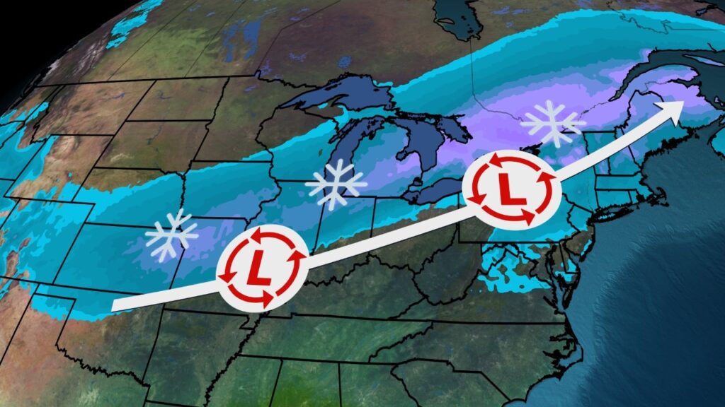
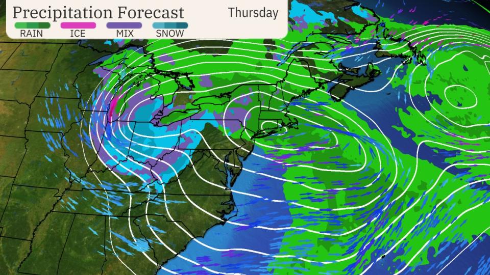
Wednesday Night into Thursday (February 13, 2025):
- Snow spreads into the Northeast, affecting cities such as New York, Boston, and Philadelphia.
- Freezing rain transitions to rain in southern New England, while Northern New York and Vermont could see over 6 inches of snow.
Projected Snowfall and Ice Accumulation
Plains, Midwest, and Great Lakes:
- 5 to 10 inches of snow expected across Kansas, Missouri, Illinois, Wisconsin, and Michigan.
- Chicago could see its largest snowfall of the season, potentially exceeding 6 inches.
- Blizzard-like conditions possible due to wind gusts exceeding 40 mph.
Northeast:
- New York and northern New England could receive 4 to 8 inches of snow.
- Boston and Hartford likely to see a wintry mix before transitioning to rain.
Ice Accumulation Risks:
- Areas of Missouri, Oklahoma, and central Pennsylvania may see up to 0.25 inches of ice, leading to downed power lines and hazardous road conditions.
- Freezing rain alerts have been issued for parts of the Appalachians and Mid-Atlantic.
Travel and Safety Impacts
The combination of heavy snow, strong winds, and freezing rain will make travel extremely dangerous. Authorities are advising residents to:
- Avoid unnecessary travel and prepare for possible road closures.
- Stock up on emergency supplies such as food, water, batteries, and medicine.
- Monitor local advisories from the Federal Emergency Management Agency (FEMA)
- Keep heating systems checked and insulated pipes to prevent freezing.
For real-time road conditions, visit the U.S. Department of Transportation (DOT Road Conditions)
Power Outage Concerns
With ice buildup and strong winds, there is an increased risk of power outages across affected regions. Utility companies are preparing for potential outages in heavily impacted areas.
Residents are encouraged to:
- Charge all electronic devices and have backup power sources.
- Keep flashlights and extra blankets handy.
- Follow safety guidelines for alternative heating sources to prevent carbon monoxide poisoning.
For official updates on power outages, visit the U.S. Energy Information Administration (EIA) (Power Outage Map)
State and Local Emergency Declarations
- Illinois, Missouri, and Kansas have declared states of emergency, enabling emergency response teams to deploy resources where needed.
- Chicago O’Hare and Midway Airports have issued flight cancellations and delays due to dangerous conditions.
For airline travel updates, check the Federal Aviation Administration (FAA) (FAA Flight Status)
What’s Next?
- The storm is expected to move off the East Coast by late Thursday, though lingering snow showers and icy conditions could persist into Friday morning.
- Meteorologists are closely monitoring the potential for another winter system next week.
For continued updates, visit the National Oceanic and Atmospheric Administration (NOAA) (NOAA Weather Forecast)
Conclusion
Winter Storm Iliana poses a major threat across multiple states, bringing heavy snow, ice, and hazardous travel conditions. Authorities are urging residents in affected areas to stay alert, prepare accordingly, and monitor updates from trusted weather agencies.
For more safety tips and live storm tracking, visit the National Weather Service (NWS Official Website).
This article has been carefully fact-checked by our editorial team to ensure accuracy and eliminate any misleading information. We are committed to maintaining the highest standards of integrity in our content.

A senior at Yale-NUS College with interests in developmental and labour economics, as well as creative non-fiction and poetry. Currently, I’m studying as an Economics major and an Arts and Humanities minor (focusing on Creative Writing) with heavy involvement in the Singaporean journalism scene and involved in research on economic history and educational policy. I’m working as an author for SKC News, Yale-NUS’ student publication, as a writer for Wingspan, Yale-NUS’ alumni magazine, and as a tutor for the NUS Libraries Writer’s Centre. | Linkedin